![]()

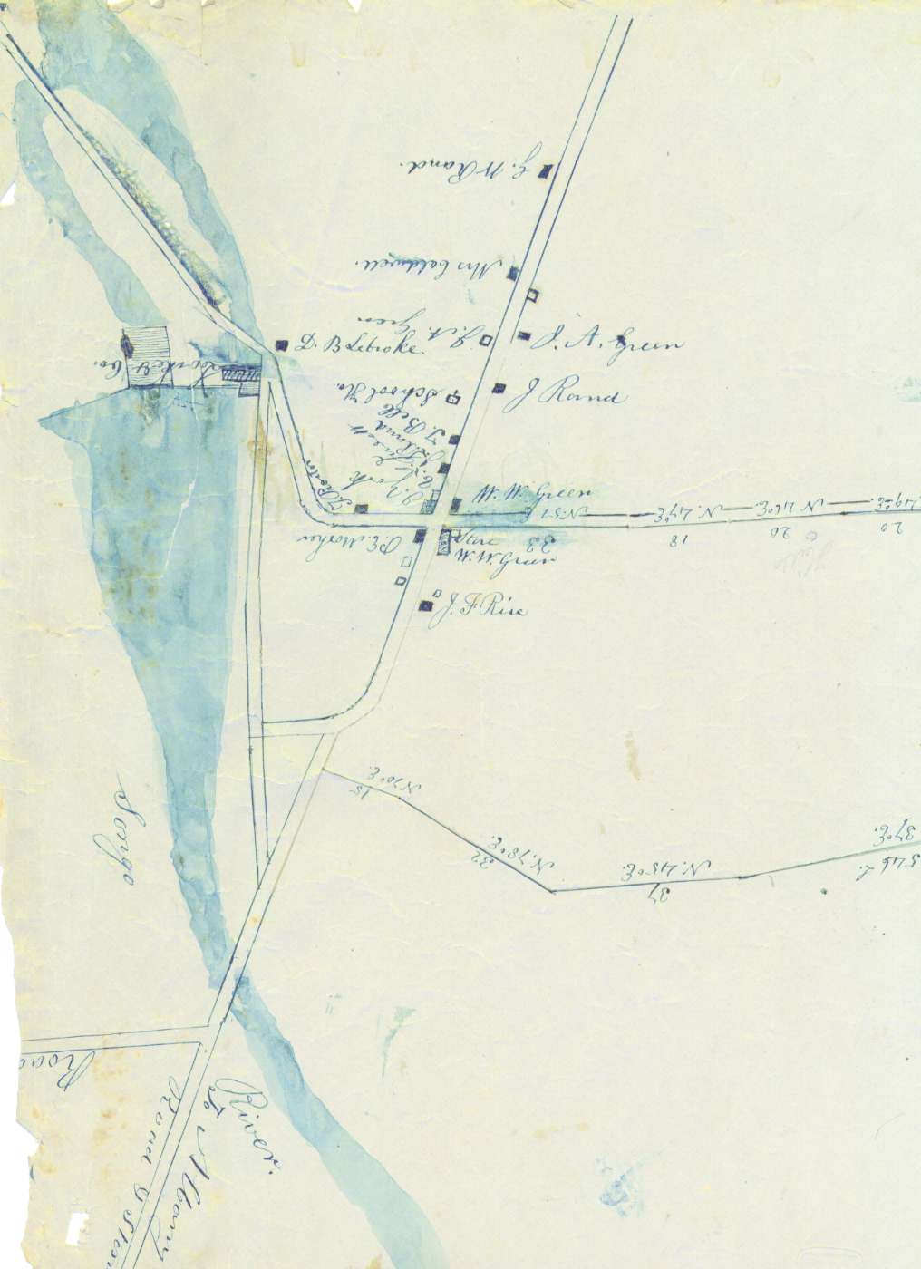
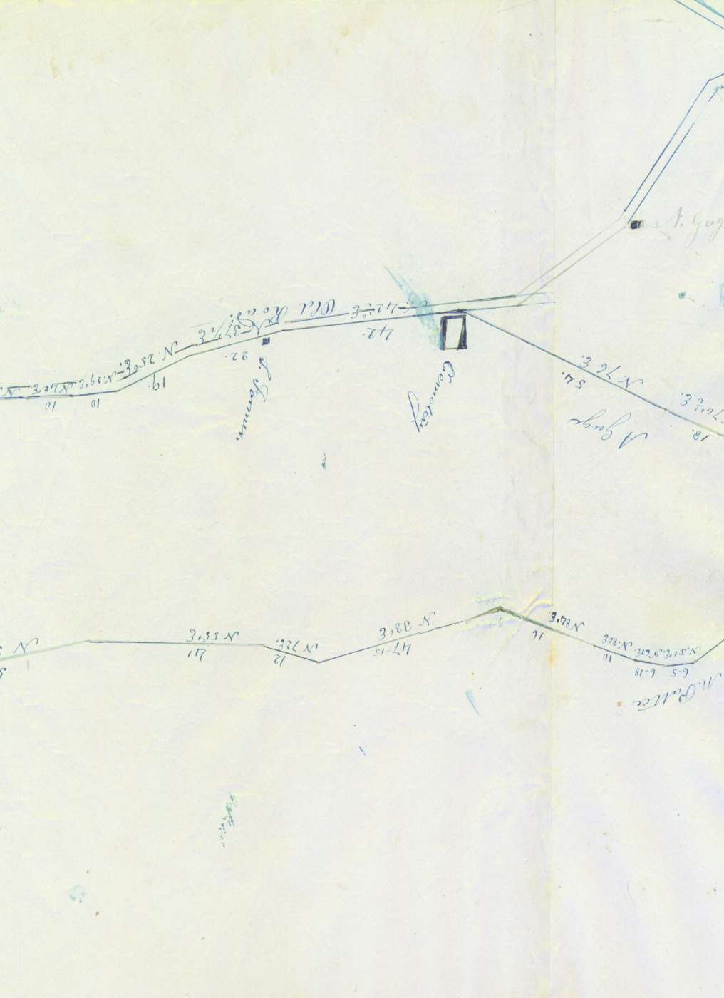
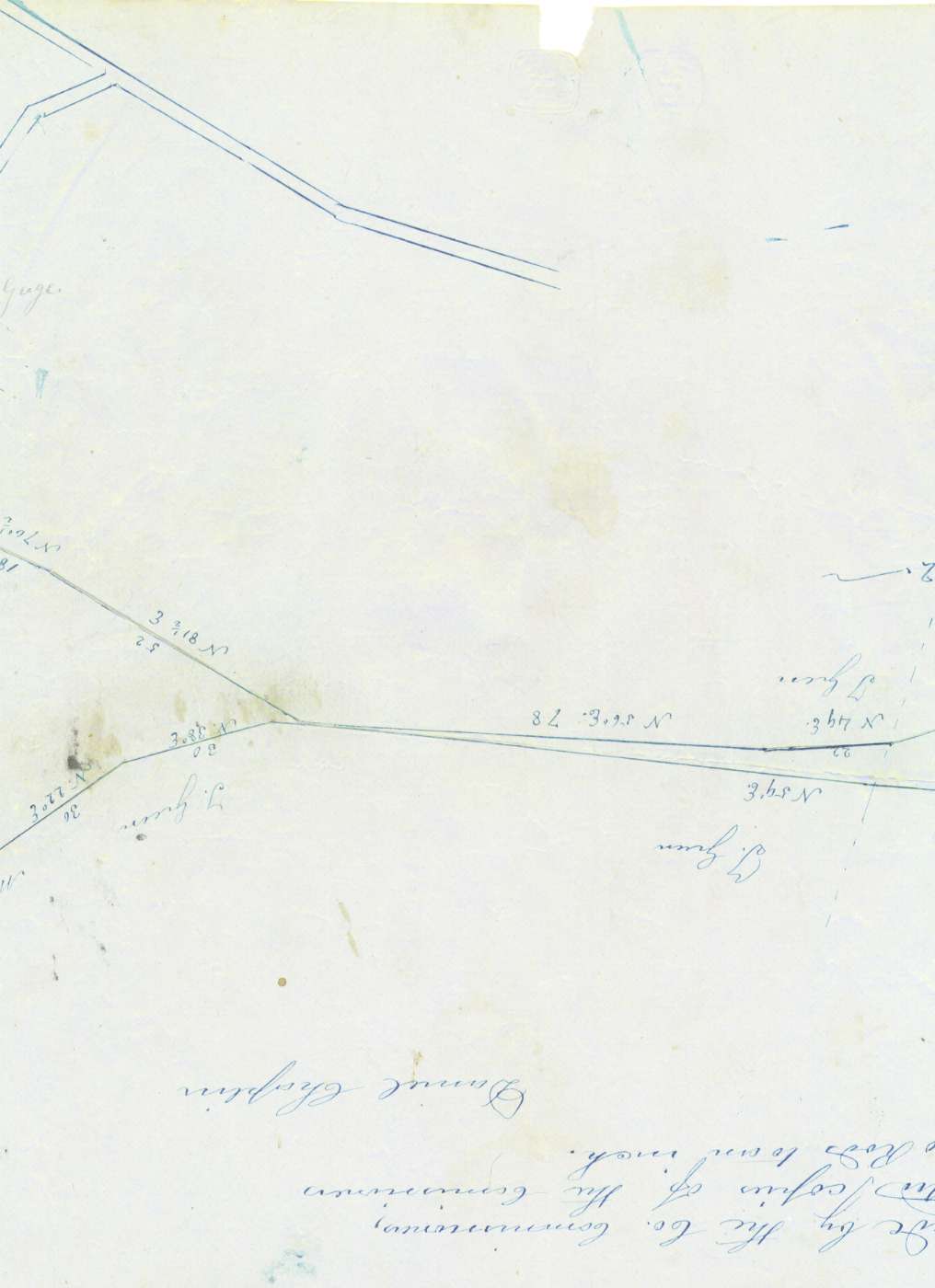
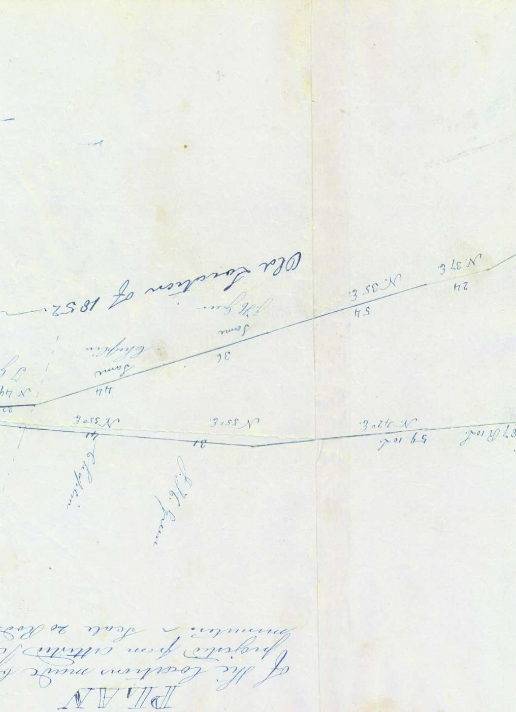
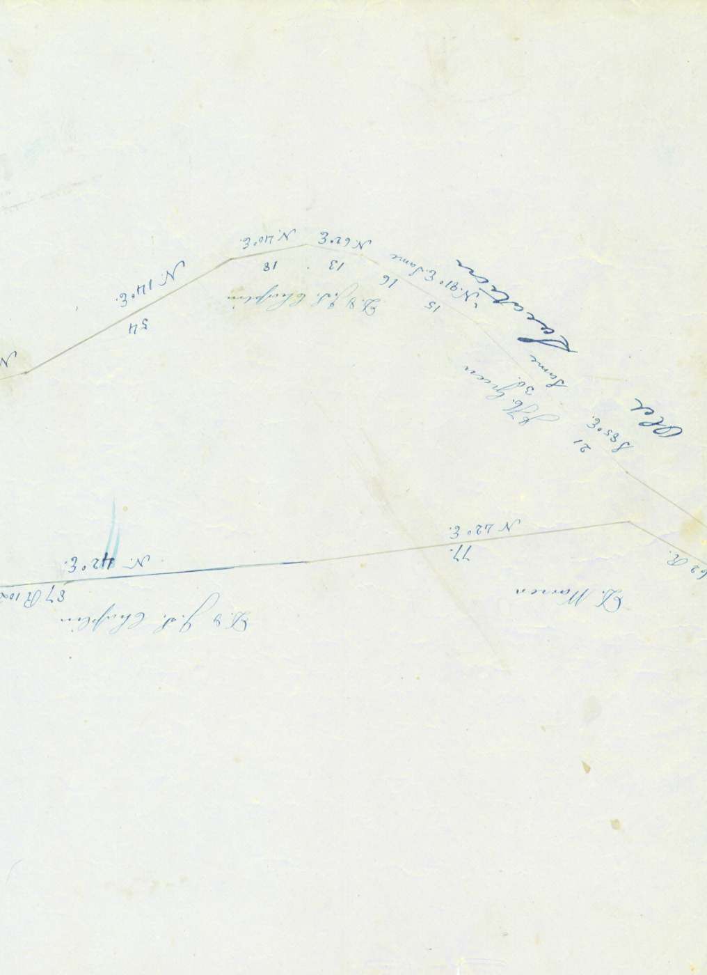
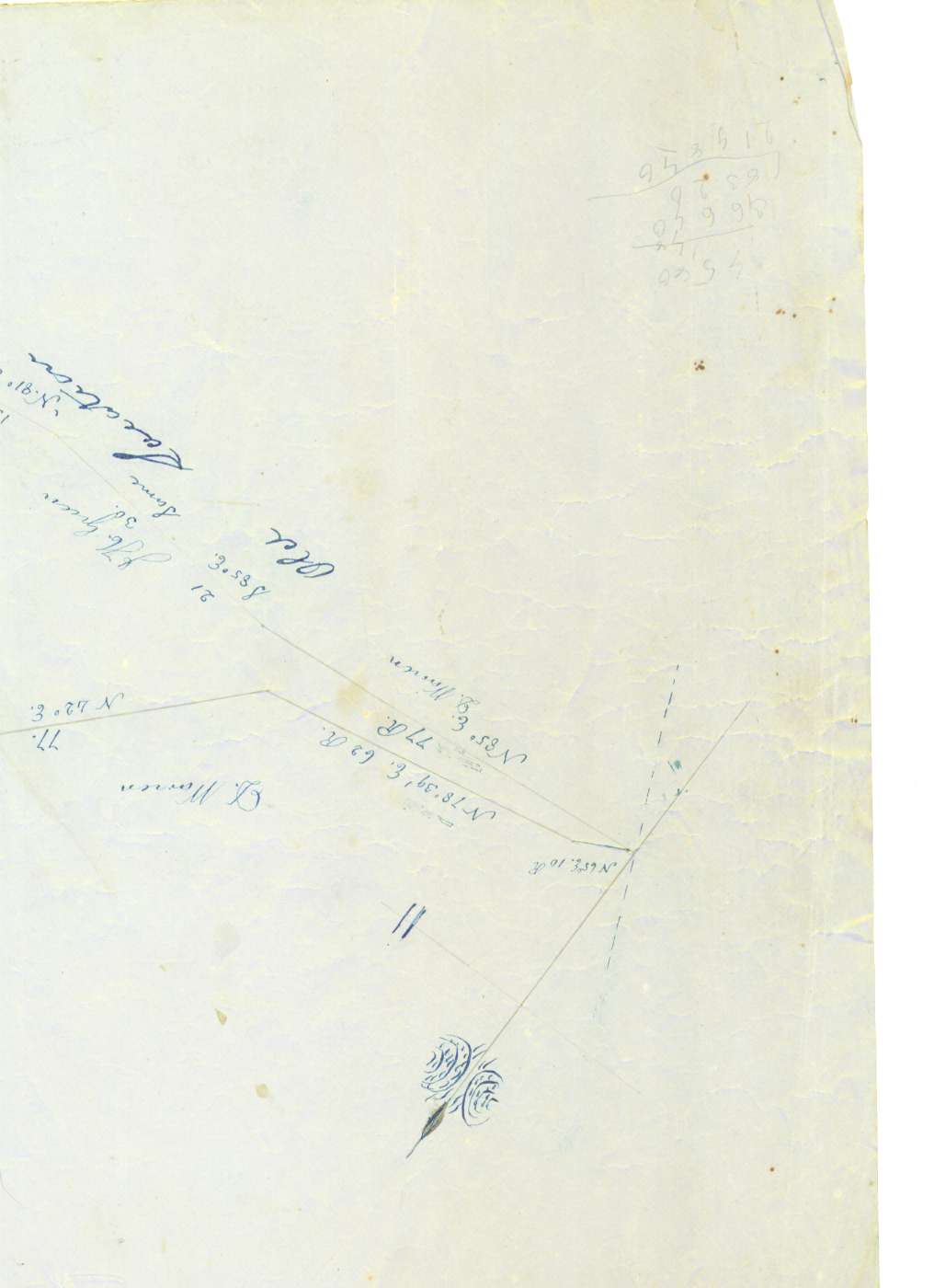
Daniel Chaplin Map of North Waterford, Maine
The original of this map was passed down through the Greene family. It is roughly 45 inches wide by 12 inches high on pale blue paper with dark blue ink. Although it is not dated, I place it as having been drawn in the late 1850s for two reasons:
- An annotation the map states "Old location of 1852" suggesting that this map was drawn some years later.
- William Warren Green's home in North Waterford center is shown in its original location, before the church was built on that site (1860) and before the Lovell Road proposed by Mr. Green was built (1862).
The map is headed with these words:
PLAN
of the locations made by the Co. Commissioners, projected from attested copies of the Commissioners' minutes. Scale 20 rods to an inch.
Daniel Chaplin
The map has been scanned in color, in six overlapping sections, as follows:
Section1(88k) Section2(61k)
Section3(64k)
Section4(66k) Section5(55k)
Section6(61k)
(Note that the map is upside down as it was scanned; north is roughly at the bottom of these images, as is the heading transcribed above.)